Hurricane forecast: Florida appears in the clear; Laura may be major for La., Texas | WeatherTiger
Ryan Truchelut WeatherTiger
Published 5:43 PM EDT Aug 23, 2020
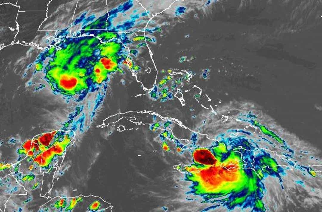
Laura and Marco are continuing to advance on the U.S. Gulf Coast, with indications mounting that Laura may be a dangerous hurricane for Louisiana or Texas.
But let’s not overlook the first threat: Marco, which is a Category 1 hurricane based on recent reconnaissance aircraft reports. The NHC’s 5 p.m. Sunday advisory has Marco with sustained winds of 75 mph and moving north-northwest at just below 15 mph.
Marco is riding the left flank of a strong ridge of high pressure over the western Atlantic, which will keep the hurricane on this general trajectory through landfall Monday afternoon or evening. The hurricane has continued to move a little more north than expected over the last 24 hours, and will likely cross the coastline in coastal Mississippi or eastern Louisiana with maximum sustained winds of 65 to 75 mph. Hurricane and Storm Surge Warnings are in effect for these coastal areas.
The central convective core of Marco remains compact, and sustained winds exceeding 60 mph only extend 35 miles from the center, mostly to the east. As further intensification or significant expansion of the windfield are unlikely through Monday as wind shear increases on approach to the coast, wind damage with Marco should be light and limited to a small area along the immediate coastline along and east of the landfall point.
A broader area will be affected by dangerous storm surge, which is predicted to be 4 to 6 feet across eastern Louisiana, and 2 to 4 feet from Lake Pontchartrain east to Mobile Bay. Locally higher inundation is possible; as always, follow guidance from your local emergency management authority regarding evacuations. Ninety percent of the casualties from tropical cyclones are caused by surge and rainfall, not winds.
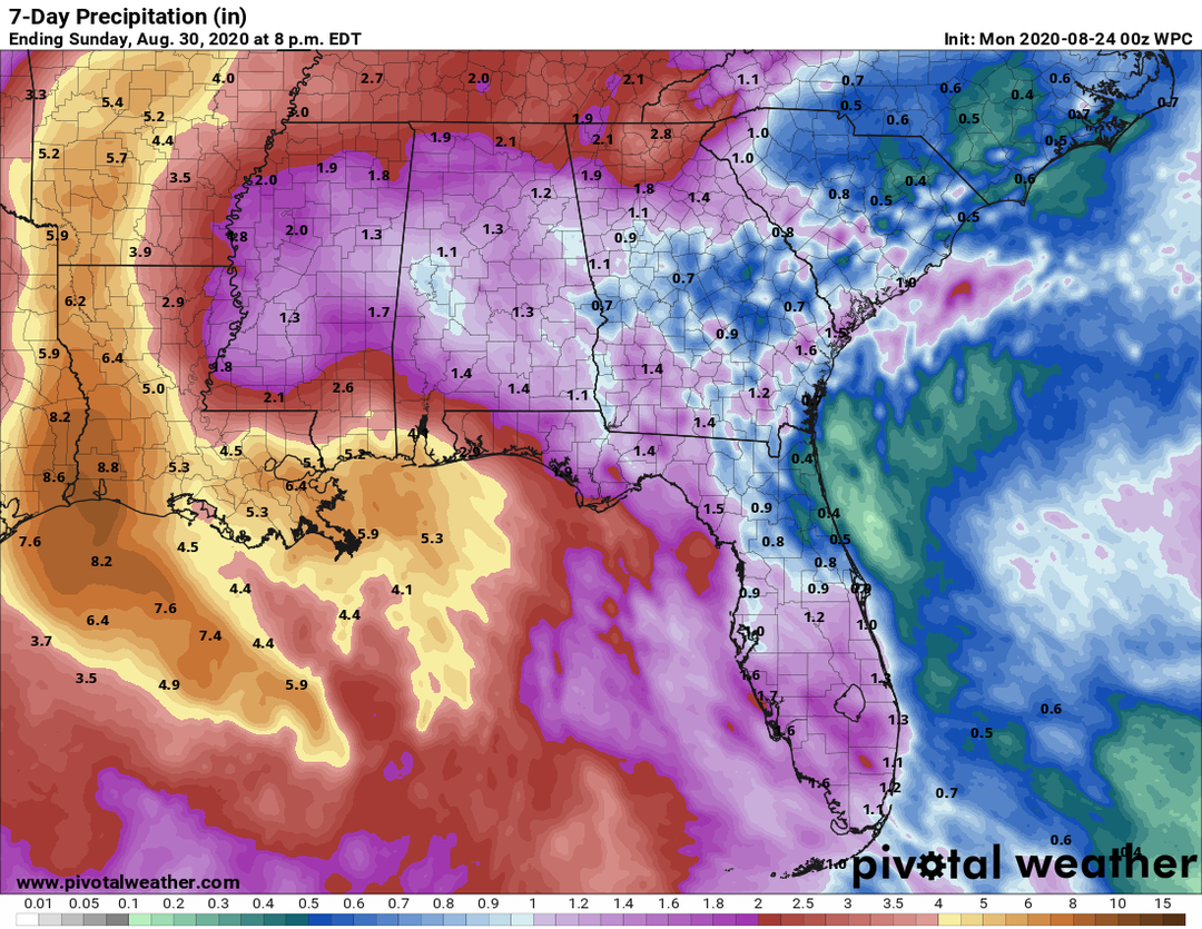
Rainfall associated with Marco already extends across much of the east-central Gulf Coast, and steadier precipitation associated with the storm’s central convection will reach eastern Louisiana east to Pensacola Monday morning.

Because Marco is a relatively small system and likely to weaken quickly post-landfall while turning more northwest, maximum rainfall totals will be on the order of 3-6 inches, with a larger area of 1-2 inch totals west to central Louisiana and east to Florida’s Big Bend over the next few days. There is also a slight risk of tornadoes between New Orleans and Mobile through Monday morning.
Tropical Storm Laura is hot on Marco’s heels and remains likely to be the more destructive of the two storms. As of the NHC’s 5 p.m. Sunday advisory, Laura’s maximum sustained winds have increased to 60 mph, and the storm is moving west-northwest at 20 mph.
In the last day, Laura plunged essentially due west across the Hispaniola highlands. Counterintuitively, a better organized system may have fared worse in this transit, as the mountains have seemingly shed Laura of its superfluous, competing low- and mid-level centers, allowing better vertical stacking of the circulations just south of eastern Cuba. Overall, the system appears much more organized than it did 24 hours ago.

Laura’s further south track has several implications, for good and ill. First, any residual risks to the Florida Keys or far western Florida Panhandle have come off the board. Ridging over the western Atlantic will shift westward to a position over Florida in the next couple days, mercifully shielding the state from this round of tropical mayhem, other than perhaps a few passing showers.
The eastern Gulf Coast’s gain is the western Gulf Coast’s loss, however. Land interaction has jumbled Laura’s track such that it now is likely to miss much of Cuba to the south. With better structural organization now in place, the very favorable shear, moisture, and SST regime Laura will be embedded in through midweek is likely to cause strengthening to commence in earnest once the storm clears Cuba.
The shift south and resulting more gradual turn to the north midweek also gives Laura more time in this favorable environment prior to approaching Louisiana or Texas on Wednesday or Thursday. Intensification, likely as not to a major hurricane, is expected as Laura crosses the central Gulf of Mexico, where water temperatures are in the upper 80s. (Unfortunately, Marco is too small and fast-moving to cause significant cooling of the Gulf.)
In general, the prognosis for Texas and Louisiana is darkening with the developments in the past 24 hours.
Laura is organizing despite its entanglements with the Greater Antilles, and a southward and westward shift in track gives the storm more time over water and less over land for the next three days. The threat of a major hurricane is rising for the western half of the Gulf, with New Orleans to Corpus Christi at greatest risk for now.
Uncertainties remain high, so keep preparing and keep watching the skies.

Dr. Ryan Truchelut is chief meteorologist at WeatherTiger, a Tallahassee start-up providing advanced weather and climate analytics, forensic meteorology and expert witness consulting, and agricultural and hurricane forecasting subscription services. For more information, visit us at weathertiger.com or get in touch at ryan@weathertiger.com.
tinyurlis.gdclck.ruulvis.netshrtco.de
